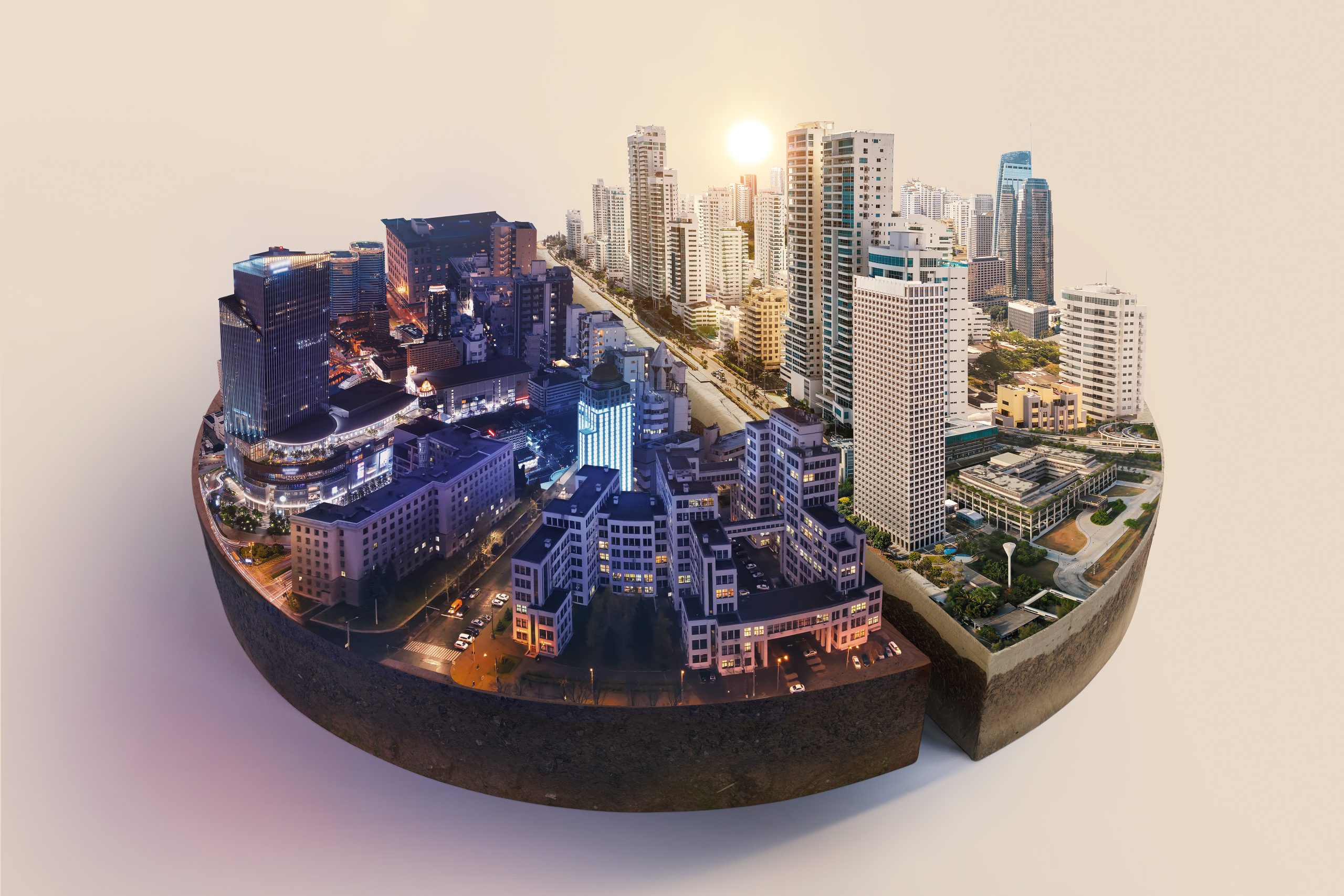
Cities are about to get a real upgrade. Imagine a world where you can zoom in on every building, street corner, and even that funky landmark you find charming (or maybe a little strange) – all within a digital environment that mirrors your physical city with stunning detail. This isn’t some futuristic fantasy; it’s the exciting world of digital twins, virtual replicas of our cities that are like hyper-realistic, 3D maps come to life. These digital twins hold immense potential to revolutionize the way we plan, design, and manage our urban spaces.
What are Digital Twins?
In essence, a digital twin is a virtual counterpart of a physical entity – it can be a machine, a building, an entire city, or even a complex process. In the context of urban planning, a digital twin is a meticulously crafted 3D model that incorporates a wealth of data. This data goes beyond just the physical dimensions and layout of the city. It can include real-time information on traffic flow, energy consumption, pedestrian movement, and even weather patterns. By bringing together this rich tapestry of information, the digital twin becomes a dynamic simulation of the urban environment.
Think of it as a powerful digital laboratory where urban planners can experiment with ideas and test out different scenarios before ever setting foot on a physical construction site. They can assess the potential impact of new developments on traffic congestion, energy use, and public safety. Imagine being able to virtually simulate the addition of a new park in a particular neighborhood and see how it affects pedestrian traffic flow or air quality. Digital twins allow for this kind of forward-thinking analysis, helping to ensure that our cities are not only well-designed but also sustainable and resilient.
LiDAR: The Powerhouse Behind 3D City Models
LiDAR, or Light Detection and Ranging, plays a critical role in building these digital twins. It’s a remote sensing method that uses pulsed lasers to measure distances. LiDAR sensors mounted on airplanes, drones, or even vehicles can rapidly capture highly accurate 3D data of a city’s buildings, roads, and even natural landscapes.
This data is then processed and combined with other sources like satellite imagery and traditional surveying techniques to create a comprehensive and realistic 3D model.
Here’s a closer look at the advantages of LiDAR for 3D city modeling:
- High Accuracy: LiDAR provides incredibly precise measurements, allowing for the creation of highly detailed 3D models that accurately reflect the real world.
- Fast Data Collection: LiDAR systems can capture vast amounts of data in a short time, making it efficient for large-scale cityscapes.
- Penetrating Vegetation: Unlike traditional imaging methods, LiDAR can penetrate vegetation cover, enabling detailed modeling of parks and green spaces.
- All-Weather Operations: LiDAR can function effectively in various weather conditions, unlike cameras which struggle in low-light or rain.
- Cost-Effectiveness: Compared to traditional surveying methods, LiDAR can be a more cost-effective way to collect large amounts of 3D data.
- Safety: LiDAR data collection can be done remotely using airplanes or drones, minimizing risks to personnel on the ground.
- Flexibility: LiDAR data can be integrated with other geospatial data sources, creating a more comprehensive picture of the urban environment.
How Digital Twins are Transforming Urban Planning
By harnessing the power of 3D modeling with LiDAR, digital twins offer a multitude of benefits for urban planning:
- Simulating Urban Growth: Planners can use digital twins to model the impact of new developments on traffic patterns, energy consumption, and even pedestrian movement. This allows them to identify potential issues and optimize designs before construction begins.
- Enhancing Public Safety: Digital twins can be integrated with emergency response systems, allowing for quicker and more efficient responses during disasters or accidents.
- Improving Infrastructure Management: Cities can leverage digital twins to monitor the health of infrastructure like bridges, roads, and utilities. This enables proactive maintenance and prevents costly breakdowns.
- Optimizing Resource Allocation: Digital twins can be used to analyze energy use patterns and identify areas for improvement. This helps cities optimize energy consumption and promote sustainability initiatives.
- Fostering Citizen Engagement: Digital twins can be a powerful tool for public engagement. Citizens can visualize proposed development plans and provide feedback in a virtual environment.
- Preserving Cultural Heritage: Digital twins can be used to create detailed 3D models of historic buildings and landmarks. This allows for better preservation efforts and facilitates virtual tours for the public.
Building a Future-Proof City with Digital Twins
The potential applications of digital twins in urban planning are vast and ever-evolving. As technology continues to develop, we can expect even more sophisticated models that integrate real-time data on everything from traffic flow to air quality. This will allow for a truly holistic approach to city planning, where every decision considers the complex interplay of social, economic, and environmental factors.
Here are some exciting possibilities for the future of digital twins in urban planning:
- Simulating Climate Change Impact: Digital twins can be used to model the impact of climate change on cities, allowing planners to develop adaptation strategies. For example, digital twins can be used to assess the risk of sea level rise on coastal cities and identify areas that need to be protected.
- Optimizing Public Transportation: Real-time traffic data from digital twins can be used to optimize public transportation routes and schedules. This can lead to shorter wait times, reduced congestion, and a more efficient public transportation system.
- Enhancing Public Health Initiatives: Digital twins can be used to track and model the spread of diseases, helping public health officials develop targeted interventions. Additionally, digital twins can be used to simulate the impact of public health initiatives, such as vaccination campaigns, to assess their effectiveness.
- Envisioning Equitable Cities: Digital twins can be used to assess the potential impact of proposed development projects on different communities within a city. This information can be used to ensure that development is equitable and benefits all residents.
- Creating More Sustainable Cities: Digital twins can be used to analyze energy use patterns and identify opportunities for improving energy efficiency. Additionally, digital twins can be used to simulate the impact of green infrastructure projects, such as solar panels and green roofs, to assess their potential benefits.
- Promoting Social Interaction and Well-being: Digital twins can be used to design public spaces that promote social interaction and well-being. For example, digital twins can be used to simulate the impact of different street designs on pedestrian traffic and social interaction.
The development of digital twins represents a significant leap forward in urban planning. By harnessing the power of 3D modeling and LiDAR technology, we can create smarter, more sustainable, and resilient cities for the future. Imagine cities that are designed to adapt to changing environmental conditions, where public spaces are optimized for well-being, and resources are allocated efficiently. The future of urban planning is bright, and digital twins are poised to play a major role in shaping the cities of tomorrow.
Conclusion
Digital twins are revolutionizing urban planning, offering a powerful glimpse into the potential of our future cities. By harnessing the capabilities of 3D modeling and LiDAR technology, we can move beyond reactive planning and towards a proactive approach that prioritizes sustainability, resilience, and citizen well-being.
Envision Beyond simply provides the tools and knowledge to make this vision a reality. As we continue to explore the potential of digital twins, we can collectively shape the urban landscape of tomorrow, ensuring a brighter future for generations to come.