Coastal and marine environments play a role in supporting ecosystems and economies due to their changing nature. Monitoring these areas effectively is essential for preserving habitats, building fisheries and addressing the impacts of climate change. Satellite imagery has become an asset in gaining insights into the conservation of coastal and marine regions. This article explores the impact of satellite technology on our comprehension of these ecosystems. Highlights its indispensable role in conservation initiatives.
With the increasing pressures from human activities, such as coastal development, pollution, and overfishing, as well as the growing impact of climate change, there is an urgent need for comprehensive and continuous monitoring solutions. Traditional methods of coastal observation, like on-site surveys and manual data collection, often fall short in providing the necessary scale and frequency of updates needed to address these complex challenges. Satellite imagery fills this gap by offering a cost-effective, scalable, and non-intrusive means to track changes in coastal and marine environments in near-real-time, making it an essential tool in modern conservation strategies.
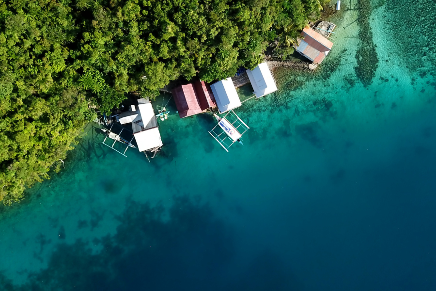
What is Satellite Imagery?
Satellite images are pictures of Earth’s surface taken by satellites circling the planet. Have uses, like mapping and tracking the environment and weather patterns as well as observing coastal and marine habitats from above to gather data that’s hard to get on land or water.
Satellite imagery goes beyond just capturing visual images; it includes data from various sensors that detect different wavelengths of light, such as infrared and ultraviolet. This multi-spectral data allows for the analysis of specific environmental parameters, such as sea surface temperatures, water quality, and vegetation health, which are not visible to the naked eye. By using advanced algorithms to process these data, satellite imagery can reveal patterns and trends in coastal and marine ecosystems, enabling scientists to make more informed decisions regarding conservation and resource management.
The Role of Satellite Imagery in Coastal Monitoring
1. Mapping Shoreline Changes
Coastal regions are constantly evolving due to factors like tides and storms as well as human interventions such as construction and dredging activities taking place there at a rapid pace every day. By utilizing satellite images that offer reliable information about the changes occurring over time in these areas—capturing the smallest movements in shorelines—scientists and decision makers can gain valuable insights into the trends of coastal erosion and land alteration. This data aids in making informed decisions, for management practices to address issues of erosion control and sediment accumulation effectively.
2. Monitoring Coral Reef Health
The richness of life found in reefs makes them a vital ecosystem in our oceans but they are at risk from factors like climate change and human activities such as pollution and overfishing. Scientists use satellite images to keep an eye out for any changes in the color and transparency of water around reefs which could signal issues, like coral bleaching or the spread of algae growths. By monitoring these changes experts can also track how ocean acidification, warming waters and other pressures are affecting habitats allowing for actions to safeguard these precious ecosystems.
3. Tracking Coastal Development
Human progress in regions is frequently essential. May pose a substantial threat to the local ecosystems balance and biodiversity. Satellite images offer a tool for monitoring the expansion of cities and harbors well as construction projects that affect coastal areas. This analysis aids in evaluating the consequences of expansions on the surrounding environments and enables better foresight, for sustainable development and protective actions to limit harm to nature.
How Satellite Imagery Supports Marine Conservation
1. Observing Marine Wildlife
Monitoring marine wildlife populations. Their movements presents challenges given the expansiveness of the oceans.Satellites provide a solution by offering coverage and frequent updates.They can monitor the movements of creatures such, as whales,dolphins and sharks through direct observation or by tracking environmental elements that impact their behaviors,such as sea surface temperatures.This information contributes to establishing marine protected areas and devising methods to mitigate conflicts, between humans and wildlife.
2. Identifying Illegal Fishing Activities
Illegal fishing that is unreported and unregulated presents a danger to marine ecosystems. By utilizing satellites that track ocean traffic and monitor vessel locations in time authorities can spot fishing vessels and crack down on illegal fishing activities ultimately safeguarding marine resources from harm.
3. Monitoring Water Quality
Ensuring the cleanliness of water is crucial, for maintaining the well being of ocean ecosystems.Satellite images offer a way to keep track of variables such as chlorophyll levels,turbidity and temperature.They serve as signals, for the quality of water.These methods enable the identification of algae growth and pollution promptly guiding officials in responding to these problems.They also aid in evaluating how industrial operations,surface runoff and other contaminants affect the environment.
Advantages of Using Satellite Imagery for Coastal and Marine Conservation
1. Large-Scale Coverage
Satellite imagery brings a benefit, in its capability of covering extensive areas at a time when ground based surveillance may be slow and restricted in range; satellites provide a broad perspective of coastal zones that offers valuable insights, on a large scale that would otherwise be unattainable.
2. Accessibility and Cost-Effectiveness
Access to satellite images has become more convenient and affordable over time.Accessible data sets from sources satellites provide tools for conservationists and scientists.These data sets enable the creation of algorithms to track changes in ecosystems without the expenses linked to, on site research work.
3. Timeliness and Consistency
Frequent satellite observations offer information on marine environments status changes over time. This real time data is vital for identifying alterations, like storm effects or rapid algae proliferation that demand responses. By receiving a stream of information updates from satellites it becomes simpler to monitor patterns accurately enhancing the effectiveness of conservation initiatives.
Emerging Trends in Satellite Technology for Coastal and Marine Conservation
1. High-Resolution Imaging
Satellite technology has made progress allowing for the capture of images, with greater detail especially in coastal areas and marine habitats, like coral reefs and mangroves aiding in the monitoring of sensitive ecosystems.
2. Artificial Intelligence and Machine Learning
The combination of AI and machine learning technology, with satellite information is improving the precision and efficiency of surveillance tasks as these tools can autonomously identify alterations in circumstances and categorize various land types, which minimizes the necessity for manual evaluation and speeds up decision making procedures.
3. Small Satellite Constellations
CubeSatellites or nano satellites are gaining popularity for surveillance purposes as they enable updates through constellation operations and offer almost real time data access. This extended coverage is essential for alerts, like identifying algal blooms or monitoring oceanic waste.
Conclusion: Envision Beyond’s Role in Harnessing Satellite Imagery for a Sustainable Future
Envision Beyond recognizes the significance of employing technology to bring about transformations, in marine conservation efforts. Our dedication to utilizing satellite imagery allows us to offer solutions for overseeing ecosystems and safeguarding endangered species while addressing the challenges of climate change. Through the integration of satellite data, with pioneering methods Envision Beyond delivers insights that empower decision makers in policy, research and conservation fields to make well informed choices for a sustainable tomorrow.
Our method merges knowledge in satellite technology with a comprehension of marine settings to guarantee that the solutions we offer are both pragmatic and significant, in impact. Let’s work together to envision a future where satellite images not just depict the state but also contribute to creating a future for our oceans.