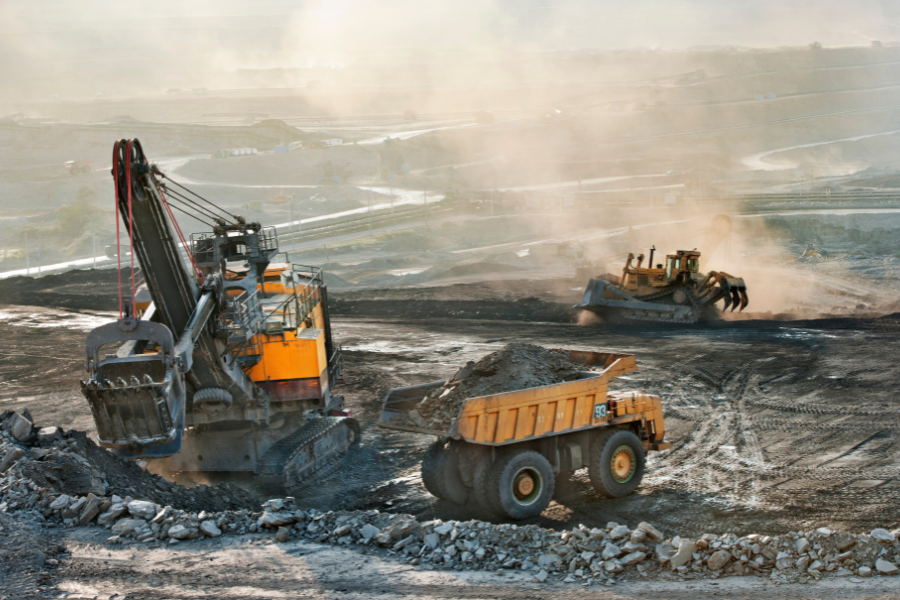
Throughout history, mining has been the cornerstone of industrial growth — providing the minerals that power energy, construction, electronics and even some renewable technologies like solar and wind. However, this advancement is not without consequence. Conventional mining contributes to alarmingly high rates of deforestation, water pollution, biodiversity loss and permanent land degradation.
Against the backdrop of global climate change and ESG (Environmental, Social, Governance) criteria gaining momentum, mining companies need to operate responsibly and demonstrate compliance while also restricting their ecological impact. Vague promises of sustainability no longer fly with governments, investors and the people who live in these communities. They want proof, transparency and demonstrable action.
This is where satellite based environmental monitoring in mining becomes a game-changer. By using the likes of optical, infrared, and radar satellite imagery, mining companies can deliver real-time, permanent and auditable environmental monitoring — taking risk off the table while providing a legacy of trust.
The Case for Satellite Environmental Monitoring in Mining
Traditional monitoring techniques age-old on-ground examination, overhead flyovers and manual recording tend to be:
- Expensive (teams have to go out to remote mines).
- Time-intensive (it takes weeks or months to collect data).
- Follow-up (problems are not detected until damage occurs).
Satellite monitoring solves these challenges by:
- Real-time near continuous monitoring of mines.
- Providing historical trend visuals to see how the planet’s health is changing over time.
- Easily covering all kinds of places, even the remotest or dangerous ones.
- Providing affordable compliance information that meets ESG standards.
In summary, satellites enable mining companies to move from reactive problem solving to a proactive approach of protecting the environment.
Deforestation Monitoring – Protecting Earth’s Green Cover
Deforestation for access roads, open pits or infrastructure is a frequent consequence of mining. Carbon emissions, habitat loss, and community resistance are all effects of forest destruction.
How satellites help:
- Optical imagery offers great “before and after” pictures of forest cover.
- Radar imagery passes through clouds to map deforestation in tropical areas.
- Change detection algorithms expose illegal or unreported clearance of forest.
Business Value:
- Shields companies from fines for unauthorized deforestation.
- Shows how it meets government permits and international agreements (e.g. UN SDGs).
- Builds reputation with ESG-investors and regulators.
Re-Vegetation and Mine Rehabilitation Tracking
But the responsibility of a mine does not end with its closure. Long-term ecological recovery requires mine rehabilitation and re-vegetation, and companies often find it hard to prove rehabilitation is happening as promised.
Satellite-based vegetation monitoring enables:
- Vegetation health is maintained through multi-spectral analysis.
- Growth progress is measured over time on the restoration plans and on nearby natural ecosystems for benchmarking.
Business value:
- Transparent reporting to regulators and local communities.
- Reduced expenses from more frequent on-site surveys.
- Greater credibility due to visible recovery proof.
Land Cover and Land Use Change Detection
The mining of the materials that make up roads, for example, reshapes entire landscapes — from the open pits of limestone quarries to excavated mountains and devastated habitats. If no one is watching, land disturbance can easily be stretched out of its proper zone.
Satellite land cover detection identifies:
- The amount of disturbed land versus operations allowed.
- Encroachment of supported habitat in protected or sensitive areas.
- An opportunity to be smarter in where and when land is restored.
Business Value:
- Heads off lawsuits with regulators, landowners.
- Develops models that predict reclamation costs on land.
- Provides substantiation for ESG disclosure.
Water Bodies Monitoring and Protection
Water is an essential ingredient in mining — to process minerals, contain waste and sustain local communities. Mismanagement breeds pollution, scarcity and conflict.
Satellite water monitoring enables mining companies to:
- Identify the water bodies located near the operational areas.
- Apply spectral signatures to identify the presence of any contamination or unusual turbidity.
- Track seasonal and climatic shifts in water availability.
Business Value:
- Defends against water-misuse related reputation risks.
- Offers advance notice of water stress and aids in utilization planning.
- Complies with local water regulations and international ESG standards.
Land Mapping and Classification for Smarter Rehabilitation
Each mine leaves a distinct ecological footprint. Satellite imagery allows classification of land types vegetation, barren zones, types of soil allowing smarter and site-specific rehabilitation to take place.
Business Value:
- Speeds up the efforts of governments by providing clear land mapping data.
- Improves cost forecasting for rehabilitation.
- Prevents unnecessary or inappropriate rehabilitation.
Change Detection for Continuous Compliance
The mining landscape can evolve at a pace few foremen anywhere see: New pits, wider roads, stockpiles. Companies cannot be trusted to maintain the approved limits without monitoring.
Satellite change detection provides:
- New disturbances as they occur are detected in or near real-time.
- Automatic alerts on breaches of the border.
- History: Records of dispute resolution and audits.
Business Value:
- Shields advertisers from regulatory fines or closures.
- Facilitates ESG disclosure compliance reporting.
- Strengthens transparency with stakeholders
Global Standards and Regulatory Compliance
Satellite-based monitoring aligns with global sustainability and mining regulations:
- UN Sustainable Development Goals (SDGs) – particularly SDG 12 (Responsible Consumption and Production) and SDG 15 (Life on Land).
- Global Reporting Initiative (GRI) – standardized sustainability disclosures.
- IFC Environmental and Social Performance Standards – guiding international investments in mining.
- National mining and environmental laws – with satellite data serving as verifiable evidence.
Business Value: Proactive compliance reduces legal risks, speeds up permitting, and improves investor relations.
The Advantages of Satellite Based Environmental Monitoring in Mining
For mining, these remote sensing based environmental surveillance systems offer both efficiency and authority. With less expensive field surveys and uninterrupted, high resolution information from satellites, they make it easy to predict with precision, plan land-use better and know in advance the risks. And they help make large or distant or dangerous sites less reliant on heavy manpower. This speed converts into thousands if not millions in savings of dollars and faster decisions are being made at the same time.
Just as importantly, they provide open, auditable data that builds trust among stakeholders. Both regulators and ESG-focussed investors will now require mining companies to be able to provide credible sustainability proof through real satellite supported evidence, turning compliance into a competitive advantage. This openness is not only good for community relations, it also helps reinforce long-term investment and operating permissions.
Conclusion – From Compliance to Leadership
The satellite based environmental monitoring in mining is more than a mere tool; it is a strategic facility. Companies that use it go even further than checking off regulatory boxes, becoming pioneers of sorts of sustainable mining practices.
Envision Beyond enables miners to incorporate deforestation monitoring, revegetation tracking, land change detection, water monitoring and more into their sustainability programs.
So, mining moves from an ecosystem disrupter to an environmental protector — really building a greener future.